EMERGING TECHNOLOGIES
Industry Team Crafting Real-Time Digital Twin of Earth
By Tabitha Reeves
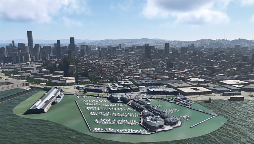
 Aechelon Technology's first test of Project Orbion with Niantic Spatial's 3D reconstruction
Aechelon/Niantic Spatial image
ARLINGTON, Virginia — Five tech companies, led by San Francisco-based Aechelon Technology, recently debuted a collaboration to create a dynamic digital twin of the Earth featuring real-time artificial intelligence-enabled updates from data collected by satellites, radars and video photogrammetry.
Project Orbion brings together Aechelon, Niantic Spatial, ICEYE, BlackSky and Distance Technologies to craft a continuously refreshed 3D reconstruction system. The companies deployed the system for the first time at the Coast Guard Aviation Training Center, according to company officials at a recent launch event.
“It is our hope and intent to be able to create synthetic environments that you actually can revisit and keep up to date within the same day,” said Aechelon CEO and co-founder Nacho Sanz-Pastor. “We think that’s going to be a transformational capability.”
Aechelon supplies the sole visual and sensor system used for pilot training across the Coast Guard — “something that we’re tremendously proud of,” Sanz-Pastor said. But the recurring challenge with the simulation systems is that they are relatively static, making them difficult and time-consuming to revise as a region changes.
Space technologies — such as satellite-based radar and high-frequency imagery updates — are the building blocks that make Project Orbion’s approach stand out, Sanz-Pastor said.
“With those, we can actually refresh the content in minutes from the time that a satellite flies by,” he said. “In some cases, every spot on Earth can be imaged multiple times a day. Things that were almost unthinkable become possible with this.”
Niantic — the company previously behind Pokémon GO — is working to ensure that “anybody with a cell phone” can become a data source for the platform by providing a real-time view of what’s happening from the ground, Sanz-Pastor said.
Because the Coast Guard already uses Aechelon’s visual and sensor system for flight training, the service can receive software updates as necessary and as available to begin utilizing the real-time 3D reconstructions, Sanz-Pastor said.
Other customers that have previously worked with Aechelon’s synthetic environment systems — including the Air Force, Navy, Marine Corps and Special Operations Command — also possess the infrastructure to begin receiving data updates with new capabilities, he added.
Project Orbion is still a work in progress, and new potential use cases for the system — such as search-and-rescue missions — continue to arise across the defense sector and beyond, officials said.
Topics: Coast Guard News, Defense Innovation

Comments (0)