ARMY NEWS
Army Experiment Brings Military Closer to Joint All-Domain Command, Control Goal
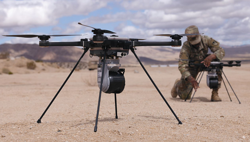 An Army soldier prepares a Ground Obstacle Breaching Lane Neutralizer drone during Project Convergence Capstone 5.
Army photo
ADELPHI, Maryland — In a nondescript room at an Army Research Laboratory facility just outside Washington, D.C., a small group of reporters donned augmented reality headsets.
Laying before them in a virtual 3D reconstruction was a full view of a large chunk of Nevada and Southern California, expanding out to the Pacific Ocean.
The Augmented Reality Sandtable — a product developed by defense contractor Anduril — was populated with green laser-like links shooting upwards, representing connectivity to satellites and high-altitude balloons carrying communications payloads. Purple and pink beams represented radars, and light pink beams symbolized electronic warfare jamming.
Virtual representations of tanks, robotic vehicles, artillery sites and fixed and rotary wing aircraft populated the desert, and small watercraft and ships gathered near San Clemente Island.
For those who wore the goggles, it afforded a Zeus-like view of the world from atop Mount Olympus.
Suddenly, a maritime battle broke out off the coast of California. Jets and robotic wingmen took off from Nellis Air Force Base near Las Vegas, and land forces began to shape the battlefield by launching precision strike missiles at the National Training Center at Fort Irwin, California, which hosted enemy forces fighting off the forcible entry operation.
“Note the enemy’s surface and air threats, including cruisers, destroyers and UAS approaching San Diego,” a narrator intoned. “Also note the various friendly classes of small surface and subsurface unmanned vehicles and their mesh communication network. Unmanned submersible vessels are performing subsurface surveillance of the enemy cruiser in the east.”
Special operators on San Clemente Island deployed high-altitude balloons with sensors and advanced communications capabilities, the narrator said. On land, U.S. and U.K. commandos set up electronic warfare equipment directed at the enemy forces to sow confusion and jam communications.
The scenario was a replay of the recently completed Project Convergence Capstone 5, organized by Army Futures Command.
Bigger and “more robust” than the previous four versions, the Army led the two-phase experiment March 10 through April 18, mostly in California.
Along with Army units, the Navy, Air Force, Space Force and Marine Corps joined, along with armed forces from the United Kingdom, France, Australia, New Zealand, Canada and Japan.
Project Convergence “is all about delivering capabilities to formations,” Lt. Gen. David Hodne, director of the Army’s Futures and Concepts Center, said at the briefing.
“It allows us to mature capability. It allows soldiers to interact with [tools], give feedback, write better requirements,” he said.
The experiments were broken down into two parts.
The A scenario — centered on the National Training Center — focused on corps and below operations and assessed the Army’s Next-Generation Command and Control technology and involved Nellis Air Force Base and expanded out to the Navy’s San Clemente Island off the coast of California.
In this scenario, maritime and special operations components opened a maritime corridor that allowed the insertion of a joint forcible entry operation centered on enemy forces located at the National Training Center. That exercise connected squads at the lowest tactical echelon to corps headquarters, Hodne explained.
Part B focused on corps and above operations using Indo-Pacific scenarios and focused more on Combined Joint All-Domain Command and Control, or CJADC2, the Defense Department’s concept that calls for links between sensors and shooters that — using artificial intelligence — will help combatant commanders make faster decisions using assets from any service or ally seamlessly.
Within those two parts, there were several “lanes,” Hodne explained.
For example, there was a medical aspect that experimented with moving wounded soldiers throughout the battlefield.
A logistics lane had an autonomous sustainment robotic vehicle moving supplies from point to point.
In the maritime fight, small unmanned submarines did the sensing, and Marine Corps units from Camp Pendleton fired anti-ship missiles from ashore. Later, so-called kamikaze boats slammed into the sides of enemy ships.
And a human-machine attack had U.S. and British Army soldiers coordinating assaults on the objective to shape the battlefield using robotic and manned vehicles, long-range fires, surface-to-air missiles and electronic warfare, he said.
Above it all, a U.S. satellite “disabled” an enemy spacecraft, knocking out one of its communications nodes.
“We integrated it all into a coherent warfighting force,” Hodne said.
While the series of capstone experiments has its roots in the CJADC2 concept, its scope has since expanded to some 250 different technologies — some of them having to do with command and control and network operations, but not all of them.
These are experiments, not exercises, Hodne emphasized.
The Augmented Reality Sandtable, for example, is a visualization tool to help observers understand the complexity of what is happening rather than a command-and-control system.
The forcible entry operation that played out in 3D on the Sandtable over a few minutes would have actually lasted about four hours.
There were “constructed” technologies in the simulation that don’t yet exist, such as the Army’s Future Long-Range Assault Aircraft. In the desert exercises, CH-47 Chinooks stood in for the yet to be fielded rotary wing aircraft during the air assault.
Brig. Gen. Zachary Miller, Joint Modernization Command commander, said the Army is using the opportunity to learn how the new aircraft will be incorporated into operations.
He noted that all the “launched effects” — smaller drones that carry out a variety of tasks — were all existing technologies with operational payloads.
As for Next-Generation Command and Control, Maj. Gen. Patrick Ellis, director of Army Futures Command’s C2 cross-functional team, said: “We don’t necessarily have a data problem. We’ve got a lot of data. … It’s not always in the right spot or the right format. That’s been our problem — we’ve had boxes that talk to boxes that talk to other boxes.
And if you want to interact with that data, you got to pull it out of the box, manipulate it, translate it, use it, put it back in, retranslate it.”
The Army went to industry and asked for a clean sheet approach for organizing the data and pushing it into a common operating picture to where a user can click on a “blue dot” on a map, and all the relevant data related to that point would come up, he said.
If that dot represented an enemy tank, for example, any drone footage or other sensor data gathered during the battle and sorted out by artificial intelligence tools would pop up.
The fourth Project Convergence capstone in 2024 had a basic version of this common operating picture, and the 2025 version expanded that to battalions, including two versions — one for combat and another for logistics.
For the next capstone, the Army wants to expand this capability to divisions.
“That’s a big step for us, to go from one small organization [of] about 500 people to an entire division of almost 10,000,” Ellis said.
Another technology leaders are excited about is a robot that deploys expendable, small drones with charges that can destroy landmines.
The Army first used a rocket launched from a trailer that carried a wire with explosives over a minefield. The detonation blasted a path through the hazardous area for soldiers.
That evolved into a drone that carried the wire more precisely over the field.
However, the war in Ukraine has the Army looking for other solutions. Previous objectives required the Army to clear minefields of about 330 feet. Minefields in Ukraine have expanded to more than 3,000 feet, which is beyond the length of the wire charges.
During Capstone 5, small drones first mapped the field and identified the landmine locations. That data was fed into the common operating picture so everyone knew where each landmine was located.
In the 3D Sandtable rendering, an autonomous vehicle with stacks of small kamikaze drones pulled up and deployed the flying munitions, each on a one-way mission to destroy a mine.
A robotic bulldozer then went into the field to assure the path was 100 percent clear. The new system doesn’t require any soldiers to be anywhere near the landmines, the briefers noted.
Lindsey Sheppard, director of the Advanced Command and Control Accelerator within the Defense Department’s Office of the Chief Digital and Artificial Intelligence Officer, said progress was also made during Capstone 5 on “getting kind of reps and sets with globally integrated decision-making.”
It supported more third-party integration into the department’s data foundation, allowing vendors to test bidirectional data flows, she said.
It was the first major experiment where the office was able to demonstrate its edge data mesh technology, which gives users in the field more access to the pertinent information, she said.
It’s important “when we’re doing exercises and experimentation — particularly with software-centric technology — that we’re taking an iterative step by step approach, using it as we would use it in a fight and ensuring that it stays behind with the users so that they can continue to work and improve and experiment,” she said.
Lt. Gen. Joel Vowell, deputy commanding general for U.S. Army Pacific, said Part B gave the command valuable insights.
“The reality of having this done forward in different countries — at sea and underway in the air and on the land — gave us really good insights of what’s working and what’s not,” he said.
The experiment showed that the multiple U.S. services and partner nations could take different programs and systems and put them into one common operating picture and work with the data easily, he said.
“That’s very helpful for commanders to be able to see data, or have a staff access the data, make sense of it and visualize it, understand it, comprehend it and use it,” he said.
But a lot of work remains before the Defense Department can declare that CJADC2 is a fully operational system linking all the domestic and allied armed forces’ sensors and shooters across all domains, he said.
Sometimes it’s a matter of policy rather than technology, he noted.
“There are policy issues on information sharing with some of our allies and partners and the systems they have, or our systems. So, there’s just some stuff we have to deal with on how data would transport between two unlike systems and different classifications,” Vowell said.
So, when can the Pentagon declare success?
“I don’t know if there’s a horizon timeline. I just know five years ago, we weren’t this close. We are a lot closer,” he said. ND
Topics: Land Forces